
ENR: LIDAR-EQUIPPED DRONE IN TESTS ON CALIF. ROADWORK
By Aileen Cho
An unmanned aerial vehicle (UAV) equipped with light detection and ranging (LiDAR) technology is being tested to document cut-and-fill work on a $74-million interchange in Contra Costa County, Calif. With an equipment cost of about $150,000, the drone’s high-resolution data-capture technology will monitor the movement of 150,000 cu yd of fill, ensuring the estimated $1-million to $2-million worth of earthwork goes as efficiently as possible.
“Five years ago, there was no way we could have put LiDAR on a UAV,” says Ed Greutert, principal engineer with Alta Vista Solutions, which proposed testing the technology to the Contra Costa County Transportation Authority (CCTA). “Now, a number of manufacturers are making units that are far more advanced, weighing 4 kilograms [8 lb,13 oz] or less.”
A French company, Yellowscan, provides the LiDAR. Weighing 3.5 pounds and consuming 15 watts of power, the device has a precision rate of 4 sq centimeters and boasts 5-sq-cm accuracy.
The scans will be used to compare contractor performance versus the plan and identify potential areas of project and performance risk. The data will be used to verify fill-invoice amounts, track materials inventory, and support project scheduling and change-order documentation. It also will be used to monitor stormwater runoff and other environmental conditions, as well as identify potential safety risks and evaluate changes in existing structures that may be introduced during construction.
Gathering the unusually high-resolution data initially involved the drone operator repeatedly adjusting to find the optimal height and speed in a trial-and-error process. “I’d say the biggest challenge we had is collecting the data we need to generate a bare-earth digital service model,” says Greutert. “During the first month, the data was not dense enough to use for our purposes.”
Another challenge is handling the massive amounts of information. “We collected 100 gigabytes of LiDAR data,” says Greutert. “Moving that around and processing it … can take several hours or overnight. Then, you tweak something and rerun the model.”
To be collected over the course of the two-year project in Brentwood, the data are expected not only to maximize efficiency of the earthmoving but also help the public to see each stage of construction, says Randell Iwasaki, executive director at CCTA. “Aerial views are hard to come by. Now, we can get a video of the progress of our project. We can take a look at environmentally sensitive areas. We can show that nobody’s in there—that we are treating those areas as promised. We can ‘fly a job’ after it rains to make sure the [runoff] control systems are working as they should.”
Moreover, Iwasaki adds, using the drone means surveyors don’t have to stand in live traffic in harm’s way.
“We are always looking for ways to be efficient and safer,” Iwasaki says. “Drones offer a golden opportunity. We can gather enough info from a drone, sensors, etcetera, so we know the taxpayers are getting their money’s worth.”
The CCTA last fall awarded the $37-million construction contract to a joint venture of Brosamer & Wall Inc. and Bay Cities Paving & Grading. The project is the concluding chapter of the Highway 4 program, a $1-billion endeavour to improve mobility in the region.
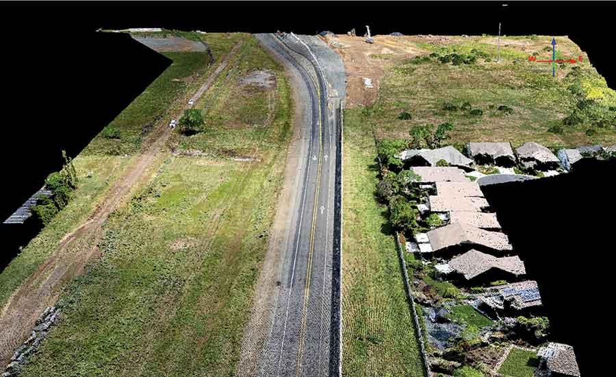
A LiDAR-equipped drone will regularly gather data during the course of a California interchange project, monitoring earthwork quantities and site conditions.
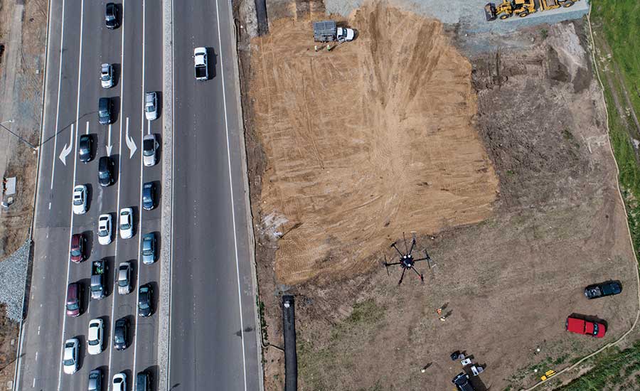
Initial test runs addressed the learning curve for gathering sufficient data.
http://www.enr.com/articles/41938-lidar-equipped-drone-in-tests-on-calif-roadwork